 Before I go on, I forgot to show you what I found in Cottonwood, Idaho - the World's Largest Beagle. This is actually a dog park; the large beagle, Sweet Willy, is a bed and breakfast and the fire hydrant surrounds a portable outhouse for humans.
Now, back to Oregon ...
The first sixty miles or so on I-95 is a trip - I changed time zones 5 times and crossed the Little Salmon River an equal number of times. I bet it is confusing to the residents of this area as to what time zone they are currently in!
I also crossed the 45th parallel, half way point between the equator and the north pole.
 As I travel around I often think of the wagon trains - with my diesel engine pulling my "wagon" up over the hills and mountains and I'm trying to hold my speed on the way down .... to do this in a wagon and on foot .without even the benefit of a road; the hardships and hard lives these people had ... so imagine my excitement to find the Oregon Trail Interpretive Center in Baker City. This is a great place. They have live, active discussions on surviving the Oregon Train, Women of the Oregon Trail, Pioneer demos, packing for the journey, snippets of their daily life, cooking on the trail, mending wagon wheels, crossing rivers, etc .... and wonderful displays and great movies giving you a great sense of what it was like .... it is NOT like you see in the movies! The part I enjoyed the most, I think, were the actual journals from the travelers and the narratives read from them along with the displays and talks. They were very interesting. It is a great place to visit.
I'm glad I did my jet boat ride on the Snake River on the Idaho side of Hells Canyon rather than waiting to do it now. It is significantly colder this week than last ... 65 degrees as a high; 35 degrees as the low.

I ended up doing this drive in two days instead of one because I started out late, and then took a side trip that ate 2 hours of my day without result. When my GPS wanted me to turn onto a hiking path that wasn't wide enough for a car, I had to go back to where I began. All and all that added an extra 140 miles onto the drive.

I combined the Grande Tour Route with the Hells Canyon Byway and this is what I saw ...
The drive started out following the river's corkscrew course upstream through cherry orchards and crop fields. FYI Oregon is the nation's leading producer of peppermint. The tour passes through Cove, a small town known for its Ascension Chapel, an 1869 episcopal church once visited by Desmond Tutu.

 |
| Union County Museum |
On through Union (a nice museum), Imbler, known as the “Grass Seed Capital of the World,” there are numerous Century Farms in the area; Elgin, the former location of Fort Baker and a trading area since the 1880s, is the gateway to the Wallowa-Whitman National Forest. Minam, Wallowa, Lostine, Enterprise (the largest of the Wallow Valley communities) and Joseph. Joseph is named for Chief Joseph of the Nez Perce Tribe; it is a cute art community with shops.


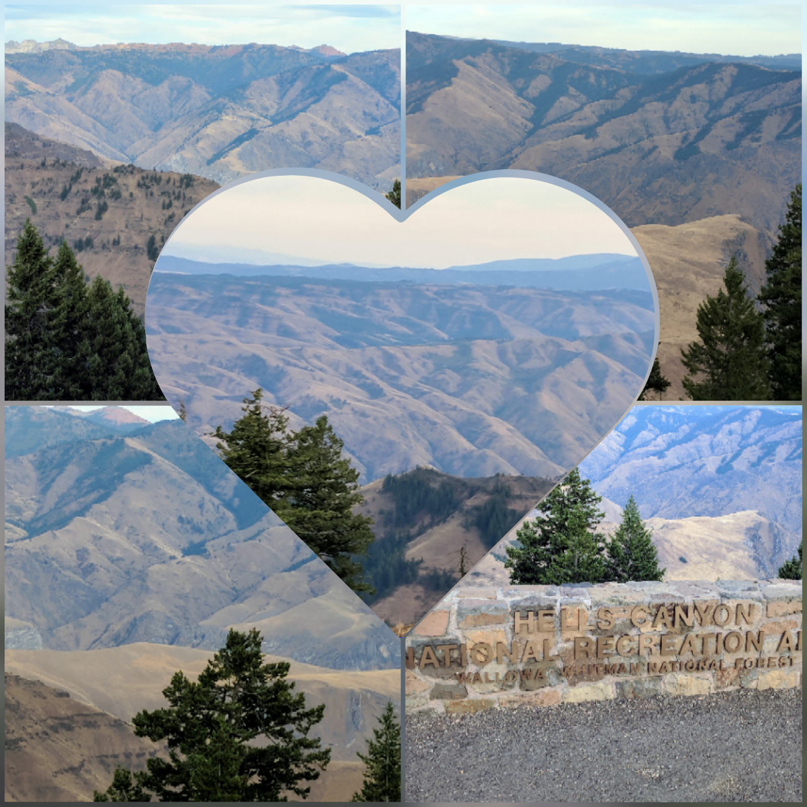
I did make the drive up to the Hells Canyon Overlook - well worth it.
There are three Idaho Power hydroelectric dams on the Snake River in Hells Canyon – Hells Canyon Dam (which I saw on my jet boat ride), Oxbow Dam and Brownlee Dam. The second two weren’t much to photograph, but the reservoirs were beautiful; the water was like glass.
 |
| Oxbow Reservoir |
 |
| Brownlee Reservoir |
Outside of Halfway, at mile post #52, there is a marker for the Tim Goodall Wagon Train route of 1862 and the Hole-in-the Wall Landslide between mile posts #30 & #31. This turnout overlooks a 1984 landslide that covered the road and temporarily dammed the Powder River.

I also visited the Baker Heritage Museum in Baker City.
Wednesday I head for Bend ....
No comments:
Post a Comment