Sunday, May 27, 2018

Wrangell-St. Elias National Park

Even in a state famous for its size, Wrangell-St. Elias stands out.  It is by far the largest national park ... Four major mountain ranges converge here:  the volvanic Wrangells, the Alaska, the Chugach, and the St. Elias - tallest coastal mountains in the world.  Together they contain 9 of the 16 highest peaks in the United States.
Few roads are as storied as the MacCarthy Road, one of only two roads entering Wrangell-St. Elias National Park.  It offers unrivaled scenery and vast and varied wilderness. The gravel road's 59 miles connect the Copper and Kennicott Rivers, roughly following part of the historic 196 mile long Copper River and Northwestern Railway railroad grade.  Constructed between 1908 and 1911 through a herculean effort comparable to the construction of the Alcan Highway or the Trans-Alaska Oil Pipeline.


Kuskulana Bridge spans a 238 ft gorge.  This is a one-lane bridge.  The 600 ft steel bridge was redecked in 1988 and guard rails were installed.  A spectacular achievement, the bridge was constructed during the winter or 1910.

Construction of the 196 mile Copper River and Northwestern Railroad (jokingly called the Can't Run and Never Will) from Kennecott to Cordova began in 1907.  The railroad would allow supplies to come in to the mines and ore to go out.

The construction challenge was massive.  The railroad had to span rivers, mountains, and active glaciers on its way to Kennecott from the coast.  Kennecott was a company town.  Most miners lived in company housing and every revolved arund mining operations.
Kennecott

The impressive ruin of a railroad trestle ... Built in 1990 that spans the Gilahina River.  This wooden trestle was originally 890 feet long and 90 feet high, required 1/2 million board feet of timber and was completed in 8 days in the winter of 1911.


Thompson Pass area (2,678 feet) has dramatic route plunges down to sea level in less than 10 miles.

50 feet of snow annually!

Richardson Hwy to Chitina

One of the many waterfalls along the road


Friday, May 25, 2018

Valdez

The road ends and Prince William Sound begins

Valdez (pronounced val-DEEZ, not val-DEZ) is the terminus of the Richardson Highway as well as the Trans-Alaska Pipeline.  Valdez is the snow capital of the U.S.A.  The annual snowfall in the city is over 25 feet per year; on Thompson Pass the average annual snowfall is over 50 feet a year.


The population of Valdez is about 4,500 people who work for the city, the oil industry, winter and summer tourism, fishing, or transportation and shipping.

Views from downtown

The harbor
When I was working on my Alaskan itinerary I debated on including Valdez or doing the Prince William Sound cruise out of Whittier.  I'm glad I had time to come to Valdez.  I had heard from Alaskans about how it was such a beautiful place ... and it didn't disappoint.

Although it is very expensive here, I did find a wonderful mechanic to work on my Jeep.  I took it to the Jeep dealer in Fairbanks twice without success ... Levi at Mark's Auto Repair listened to my description, knew what was wrong, test drove to verify and then fixed it immediately for $45.

Remember all that mud on my vehicles?  Well, that happened several times.  I paid a car wash $35 to hose off the underside and wheels, but mud still dried in the wheel wells and EVERYWHERE and that was the problem.  Some time with the pressure washer took care of the problem.  That mud dries like a rock.  I was joking with another customer about the Alaska mud I had seen so far.


On March 27, 1964, the infamous Good Friday earthquake struck Alaska, just 45 miles west of Valdez.  It lasted over 4 minutes (measured 9.2 and was the most powerful ever recorded in North America), causing an underwater landslide that in turn triggered tsunamis.  One washed away the waterfront.  The Valdez townsite was condemned and the entire town moved to its present location, four miles east of Old Valdez.  52 buildings were moved; the rest were razed.

And then on March 24, 1989 The Exxon Valdez oil spill occurred when Exxon Valdez, an oil tanker bound for Long Beach, California, spilled 10.8 million US gallons of crude oil over the next few days. It is considered to be one of the most devastating human-caused environmental disasters.

More fun to follow ....

Sunday, May 20, 2018

Richardson Highway - Fairbanks to Valdez (368 miles)

I was told this was a beautiful drive - not to be missed.  One of the few times I wished someone was with me to take pictures.  Valdez is as beautiful as advertised as well. (FYI not one scrap of little the entire length)

The Richardson Highway was the first real road built in Alaska.

As I left Fairbanks (the largest city in interior Alaska), my first stop was Delta Junction. It marks the end of the Alaska Highway.  At the Visitor's Center, I finally got my certificate for driving the Alaska highway (it was closed when I actually came through the first time).  I also had an interesting conversation with the ranger.  She told me people actually argue with her that they are still in Canada and ask her if they have running water and bathrooms in Alaska.

Cranes in Fairbanks
Buffalo country


I stopped at Copper Center Visitor Center for Wrangell-St. Elias National Park (the largest National Park in the United States) to get some information and my park stamp.  Since it is not "open" until this weekend, I'll have to drive back up to explore Kennicott National Historic Landmark, etc.

I have been lucky enough to see several moose and lots of caribous, but all I seem to get is their rear end.  As soon as I approach for a picture, they turn and give me the brush. 
Moose


Start of a railroad tunnel hand-cut into solid rock
Like driving through Oregon and Washington, beautiful waterfalls along the road ..
Bridal Veil and other falls


I'm in Valdez for 10 days.  I have a glacier cruise around the Prince William Sound booked, as well as a trip back to Kennicott.  It is beautiful here, but colder than Fairbanks (snow in the forecast for next week!), and the nights actually get mostly dark.

Thursday, May 17, 2018

Dalton Highway - Deadhorse to Fairbanks - the second 500 miles


Deadhorse is not a town but an industrial camp that supports the Prudhoe Bay oilfields.  There are few amenities for visitors.  Lodging is extremely limited and there are no grocery stores, public outhouses, or camping areas.  The public highway ends about 8 miles from the Arctic Ocean.  You must be on an authorized tour to visit the Arctic Ocean (and I was, of course, too early).

I spent the night at the Prudhoe Inn.  For my $120 room (higher because it had a private bathroom) I received a really good buffet dinner and breakfast and a sack lunch to take with me the next day.  The offerings for the lunch were great.

Of course, it snowed all night ...

Was this such a good idea?
Thousands of migrating birds in the marsh


Shy caribou that did not want their picture taken (and fog)

Muskox

Don't these frozen bushes look like they are dipped in white paint?
They are actually moving part of the Dalton Highway because part of a glacier is melting faster than anticipated and, if it breaks off, will wipe out the road and part of the pipeline.  As I was waiting for the pilot car, I had a really nice conversation with Kat, from Sweden via Philadelphia and Montana.   She was telling me as road crew she gets paid a lot of money and they only work 4 months a year; her and her husband live in a cabin with no running water and an outhouse.  In the winter she works with a dog sled musher.  Her husband does seismology; the original reason for moving to Alaska.

When I stopped to talk to her on the way back we discussed the REALLY stupid people who try to bike or walk the Dalton Highway.  An oil worker was telling me they fly into Deadhorse with their bikes, totally unprepared, and try to bike to Fairbanks.  Some walk.  Several get killed.  And the semis don't slow down.  There were 4 bicycles and one walker on my return.
This was the last 70 miles of the road into Deadhorse.  I felt like I was coming in for a landing.

Besides the snow, I had hail, fog, rain, 16 degrees ..... and no bathroom.  When the sign says "no services" they mean it!  The guide books tell you to carry extra water and food and have a full tank of gas  and a spare tire, but don't mention the 200 miles between restrooms
 .

I did see an Arctic Fox running across the tundra.  I was told it is rare to see them.

Gas was $4.80/gal in Deadhorse.  A super nice guy, Terry from Montana by way of San Diego, came out to show me how to use the pump.  A gentlemen ... offered me his arm so I wouldn't slip on the ice and then pumped my gas.  While we talked he explained how they work, etc.  There are 2 guys assigned to every job; one has to be there at all times so you can't change your schedule or ask for time off.  They work either 2 weeks on and 2 weeks off, or 3/3 or 4/4.  When they work, they have no time off ... 24/7.  Everything is provided for them ... even their clothes, so they don't bring money or anything with them.  The company provides a flight in and out; no one lives in Deadhorse. And they get paid a boat load of money, although no one would put a number to it.

Their busy time is actually the winter because they can drive across the ice to Barro, and out to the drilling, etc.  They are not allowed to drive on the marsh if any gravel is visible on the road.

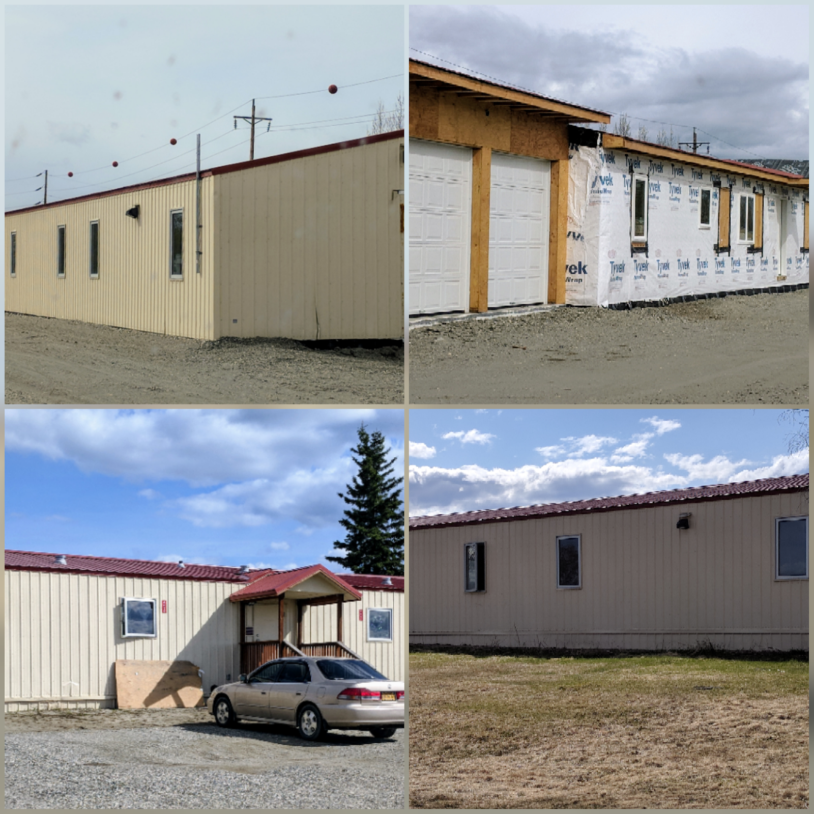
I told him the "housing" looked like storage containers, but he said they were actually very nice on the inside.


When Terry was pumping my gas, he threw out a hazmat on the ground before he started.  To my question, he told me that the environmentalists have a fit if even one drop touches the ground, so they have to put the mat down in case of spillage.

As the temps rose into the 20s on my drive back, the road conditions deteriorated as I went.  At one point I was actually "riding" a mud slide down a grade and just prayed I wouldn't have to stop!


Besides the weather, the one consistent thing this trip is the frequently asked question ... "are you by yourself???"

Wednesday, May 16, 2018

Dalton Highway - Faribanks to Deadhorse - 500 miles


At first, the highway was called the Haul Road because almost everything supporting oil development was "hauled" on tractor-trailer rigs to its final destination.  In 1981, the State of Alaska named the highway after James B. Dalton, a lifelong Alaskan and expert in arctic engineering who was involved in early oil exploration efforts on the North Slope.

In 1994, public access was allowed all the way to Deadhorse for the first time.

The road is narrow, has soft shoulders, high embankments, and steep hills, lengthy stretches of gravel with sharp rocks, potholes, washboard, and clouds of dust or slick mud... and snow any time of the year.
The ever-present pipeline
The pipeline has zig-zags in it for no apparent reason.  I confirmed with a road crew worker that they are intentional to help control the flow of oil in the pipe.

Mile Post 98
MP 115
The Roller Coaster - a series of steep hills named by truckers in the early years of pipeline construction, including Sand Hill, Roller Coaster, Mackey Hill, Beaver Slide and Gobblers Know  Truckers today use the same names.

I later learned from an oil worker in Deadhorse that all the landmarks along the road are named so the truckers can report their current location to other truckers.  As the road is narrow, the truckers need to know if there is a wide load upcoming where there may not be room to pass.


Grayling Lake - An ancient glacier carved this U-shaped valley and left a shallow lake.  Moose feed on the plants in summer.  Charcoal, stone scrapers, and other artifacts found nearby indicate that Native hunters used this lookout for thousands of years.


Coldfoot - yep, this is all this is.  The original gold rush town of Coldfoot was located on the Middle Fork of the Koyukuk River near the mouth of Slate Creek.  It got its name in 1900 when early prospectors reportedly got "cold feet" and left before winter set in.  (Gas was $4.60/gal)
Sukakpak Mountain (MP 204) - A massive wall rising to 4,459 feet.  Sukakpak is an Inupiat Eskimo word meaning "marten deadfall." 


Wiseman is an historic village established in 1907 when miners discovered gold in nearly Nolan Creek.  Many residents today subsist by hunting, trapping and gardening.
And then it started to snow .....

Monday, May 14, 2018

And even more Fairbanks ...

I can't say "Fairbanks, the end" because I actually come back this way in a couple of months on my way to the Artic Circle....

My weather fact for today (on my phone) is:  The winter of 1936 in the US was so cold that Niagara Falls froze completely.  Was that suppose to make me feel better?  ha.

I can also tell you that the best natural windshield cleaner is frozen slush coming down from your roof across the windshield.  Nothing is left -- not even a bug wing.  It sparkles.  I just wish it would clean the rest of the coach as well.

A Spam omelette was the breakfast special at the dinner this morning ....

I have spent some time at the Jeep dealer (twice) and at the nail salon talking to locals and found out some interesting facts ....

  • The school children play outside at recess until it is colder than -20 degrees, and then they play inside.  Even the kids don't think that is too cold.
  • There are approximately 30 gold mines in Alaska, the newest one being around Nome.  That one has an estimated 28-year vein.  If you live here and are not in the military, then you probably work in one of the mines or the pipeline or drive a truck or work in the tourist industry.  The locals don't think the prices are high because they make more money than the lower 48.  For instance, a trucker  hauling for the pipeline makes about $1,000/day.  I think I've found my new job!

    I did find some blue sky ....
  • It is usually green and very pretty here this time of year; again, no local will admit to remembering winter lasting this long. Also, this terrible wind they have that I hate, they don't usually have.  Apparently, they don't normally have any wind.


  • It is very expensive to build a house here, so if you can find an old house to buy, that's what most people do.  They don't maintain the outside because of the elements and the short season, but apparently the inside of the house is wonderful.  That's where they concentrate all their time and money.

As I may have mentioned, I am staying in a mobile home park because the campgrounds are still closed.  I have almost everything I need and the price isn't bad, so it works.  We have had a couple warmer days and the lake has melted and the ducks have arrived.


I did walk around and take some pictures for you ....

The residents either live in very run down mobile homes ...


Or in one of these buildings .... of which they are building more.  I would have expected more pitch on the roof, but they don't get a lot of snow here.


I'm sure the lack of windows helps in the winter, but it must be miserable in the summer.  They are heated from a big rusted oil drum laying in a cradle on the side of the house.  You can buy heating oil at any gas station ... it's one of the pumps, like diesel.


  • You do get used to the "dark" as well as the "light" .... as one lady said "you just have to keep busy."  It is up to about 20 hours of  "light" now (not to be confused with "sunshine"), except it doesn't really get dark; more of  like "dusk."  I haven't make it to bed earlier than 1:30am so far because I just don't realize it is that late.  A local was telling me this morning that he has run to Lowe's a few times, not realizing it is 3am and they are closed! (He's retired military and now does heavy machinery for the local mine.  His wife hates it here, but he won't move).
  • The mosquitoes .... I just had to laugh.  You read the literature and they talk about the mosquitoes, but until you are hit with a cloud of them, you just can't picture what people are talking about.  It was unbelievable; never did I imagine.  I got out of the Jeep to get gas and there were thousands of them. I quickly got back in the car, but to see the hoard against the white Jeep ... not a good idea to stand with your mouth open! They spend the winter under the ice and snow, so as soon as it melts there they are, all hungry .... and they are worse as you go North, I am told.
  • Although we are actually in Alaska Standard Time, apparently we don't care.  The locals feel that time doesn't matter up here, so most just keep to Seattle time, as that's where they do business or have contacts.
  • Everyone carries, you don't need a carry permit, and if you need to go down to the 48 and you fly, Alaska Airlines will allow up to 50 lbs of ammo and guns in your suitcase.  If you drive, there is a mail service that will mail the gun/ammo down for you ... USPS!  So, why do I have to sign that my package doesn't contain anything harmful??? ha. 
  • I got an explanation about the empty grocery shelves in the stores ... They used to have a Sams Club in town.  People living out of town come in once a month, or every couple of months, to stock up on supplies.  Now that they don't have a "bulk" shopping place, these residents clear the shelves in the regular markets.  If they need 12 bottles of ketsup for the month/or 2, then there is no ketsup for the rest of us.  ha.